.jpg)
This post is a bit different from the others in that none of the pictures are mine. My phone broke on day two of the trip, so I wasn’t able to take any photos! I turned it off at night, and it simply wouldn’t turn on in the morning. I tried to take this as a rare opportunity to be fully present in the moment and decouple from the urge to seek out cool shots, but I definitely felt a bit aimless at times, as snapping photos in the wilderness is one of my favorite activities. Taking photos helps me appreciate and focus on subtle aspects of nature, though it definitely removes me from the moment. The ones I do have are a collection of those taken by my friends, but there are some days that will go completely undocumented – it’s a little sad, but also liberating and empowering, to think that those days were exclusively for me, that I won’t be able to share them with you all. In a way, that’s really the purpose of these trips: to get in the zone, tune into my own energy, pursue only the movements that feel good and worthwhile, walk only the trails that feel exciting and challenging.
Late summer and early fall is a special time in the high country of the American West: last winter’s snow has all but completely melted, exposing the alpine tundra, deep blue alpine lakes, and lofty passes between rocky summits. The afternoon sun is high and warm, but nights approach freezing and snow is only a few weeks out. I have many great memories from my time in Colorado exploring Indian Peaks Wilderness in late September when permits are no longer required and the aspen leaves burn yellow and flutter in the thirsty air. Since moving away from Colorado, these trips have expanded into multi-week visits to the alpine tundra, one of my favorite landscapes on Earth.
The idea to explore the Olympic Peninsula originated when my parents planned a mid-September trip to Washington. During my time living in southern Chile in 2018, I came to love the lush rainforests, glacial landscapes, and foggy ports of northern Patagonia, so it only makes sense to experience the northern hemisphere equivalent. In my many years of putzing around mountain wilderness areas, I have learned that the only mountains for me are the misty ones: I belong in the cool and damp with the slugs and mushrooms. I decided to join my folks for the first half of their Washington trip in the North Cascades (northeast of Seattle), and cooked up a couple weeks of backpacking trips on the Olympic Peninsula beforehand so I could get my trail kicks and then join them when I am ready for a more leisurely experience. On April 1st of this year, I woke up at 6am and battled hundreds of other eager backpackers for Olympic National Park permits. Among my notes from last year’s John Muir Trail excursion was the potential appeal of breaking up trips with nights indoors, so in that spirit I planned three “sub-trips”, interspersed with Airbnb nights:
- Grand Loop (3 nights, northeastern Olympic Mountains)
- Airbnb Night in Port Angeles
- Shi Shi Beach (2 nights, northwestern coast of the Olympic Peninsula)
- Airbnb Night in Forks
- Hoh Rainforest and Seven Lakes Basin (5 nights, northwestern Olympic Mountains)
I recruited a rotating cast of characters to join me on these excursions, including my friends Meesa (Grand Loop), Will and Charlie (Shi Shi Beach), and Dave and Amy (Hoh Rainforest).
But first, a quick summer recap. Last time I wrote, I was staying in Bend, Oregon with friends Dave and Amy. Since then, Raf and I met up in Minnesota, where we hung out with my family for a couple days and then spent a week or so at my parents’ cabin in northern Wisconsin, where I taught Raf to sail. Next, we made our way to Windsor, Ontario, where I met Raf’s Aunt Josie and her clan, and then spent a week at Duff’s Cottages on Lake Muskoka with Raf’s Aunt Mary and her clan. It was great to meet so many members of Raf’s family! We then parted ways – Raf to Vida Verde to start work, and me back to Bend for a few days before I departed for Washington. It’s been an incredible summer and this Washington trip is the grand finale.
This is a long post, so I encourage you to read in chunks – maybe one trip / block each day. Last year on the John Muir Trail, the mantra "walk swiftly and carry a heavy pack" stuck with me. This year on the trail, I came up with an oath that reflects my approach to backpacking and the outdoors in general:
I strive to rely more on...
Grit than Gear
Fitness than Finance
Intuition than Information
Experience than Expertise
1. Grand Loop: (Photos Courtesy of the Badass Meesa Paloma)
Sunday, August 27: Deer Park Trailhead to Falls Camp (10 miles)
After a restful night sleeping in the back of my truck somewhere in Tacoma, I pick up Meesa at SeaTac airport around 8am and we drive around the Puget Sound toward Port Angeles in a sort of reverse J shape. Just before Port Angeles, we turn southwest up Deer Park road and climb ~5000 ft up to the trailhead. In a reversal of the typical mountain trail experience, we begin by descending ~2000 ft through bearded, carpeted forests of hemlock, cedar, and fir to the confluence of Gray Wolf, Cameron, and Grand Creeks. These three basins are the main areas we will explore on the trip. Having built up some heat, we submerge in frigid Grand Creek and then do a Croc high five. We then work our way into the Gray Wolf basin and steadily ascend to Falls Camp. I tend to walk a bit faster than Meesa, but I stop at every creek to drink water through my Lifestraw and Meesa catches up – it’s a good rhythm. Along the way, we get whiffs of smoke from the nearby fires on the mainland and Vancouver Island, but nothing to be too concerned about. For dinner I eat refried beans, while Meesa eats curry. In the middle of the night, we wake up to the sound of a tree crashing down very closeby!

Monday, August 28: Falls Camp to Upper Cameron (14 miles)
The next morning, we ascend to Gray Wolf Pass (~6200 ft), where I try to turn on my phone to take pictures, only to discover that it is not responding. We eat a quick lunch (salted avocado and hemp hearts for me) and then descend ~3000 ft through a light drizzle down the steep southern side of Gray Wolf Pass into the Dosewallips River Basin. The descent is pretty magical – the forest canopy is regularly interrupted by steep avalanche chutes where wildflower meadows have taken root. We follow the Dosewallips River west-ish for a few miles, and then turn north again toward Lost Pass (~5600 ft) on a trail that ascends ~1000 ft in switchbacks over a very short distance into the Lost River Basin. Just before the ascent, I make the mistake of eating a hefty quantity of hemp hearts, which start to slow me down as I begin the climb.
About halfway up, we pause as an afternoon squall collides with the mountain in a maelstrom of thunder and lightning (apparently a very rare occurrence on the Peninsula). The storm moves on quickly and we slowly climb to the crest of the ridge, where we meet a friendly hiker named Dan, who points out a small fire in the distance that was probably started by the afternoon lightning. We are pretty beat after two passes, but we press on towards Cameron Pass (~6500 ft), our third of the day. Near the pass, I start to really slow down, my belly full of hemp hearts. In an unprecedented move, Meesa cruises past me and reaches the top first – I am grateful and humbled to have finally been bested (at least just this once). On one of my many breaks on the way up, I take in views of Mt. Olympus and its many glaciers to the west. We hobble down to Upper Cameron basin and set up camp near our new friend Danno. I eat cheesy potatoes, while Meesa eats another curry. During the night, another storm rolls in with plenty more thunder and lightning and soaks Meesa’s tent (they forgot to stake out the rain fly).


Tuesday, August 29: Upper Cameron to Badger Valley (11 miles)
Our easy day has arrived. We enjoy a slow morning at the campsite and I do some stretches while Meesa dries out their tent. We descend down to about 4000 ft and then climb up to Grand Pass (~6500 ft). The last thousand or so feet of the ascent take us up a fiery yellow-orange alpine meadow with a colony of resident marmots and views of the Cameron Basin to the south. In the higher elevations, I’ve been noticing a shaggy tree that I had never seen before – it looks like some sort of cedar, and seems to be very prevalent just below treeline, alongside the subalpine fir and spruce. I later learn this is known as the Alaskan Yellow Cedar, my new favorite tree. We make our way down past a series of alpine lakes – Gladys, Moose, and finally Grand Lake, where we stop for a late (~3pm) lunch (rice noodle soup for me). Our permit has us camping here at Grand Lake, but we decide to press on another few miles into Badger Valley to give us the best chance at getting back to the trailhead the next day with enough time to check in to the Airbnb and pick up Will and Charlie at the Port Angeles bus station (4pm). In Badger Valley, we set up camp in a wide and flat subalpine meadow with many badger holes and a group of rocks that have a mystical vibe. We sit and watch the threatening fog roll in and out of the valley in chilling sweeps.


Wednesday, August 30: Badger Valley to Deer Park Trailhead (8 miles)
Our final day begins clear and cool with an ascent up a few thousand feet onto a ridgeline that spans the distance between Obstruction Point Trailhead and Deer Park Trailhead. A hiker from Port Angeles later tells us that this route was going to be paved until World War II sidelined the project. Walking along this ridge is undoubtedly one of the high points of the trip, with views of the three basins we have already explored (Gray Wolf, Cameron, and Grand) to the south, and the sun rising above a thick fog bank to the east. We walk along this ridgeline for about six miles and steadily descend a couple thousand feet back to Deer Park Trailhead, where we hop in my truck and switchback our way down to Port Angeles. There, we eat lunch at an awesome Asian Buffet, which features a Pho Bar where you choose all your own ingredients (beef, cabbage, and egg noodles), they cook it in broth for you, and then you add your own garnishes (scallions, bean sprouts, and cilantro). Amazing!
“Wow, what a great trip. It just flew by – maybe because of all the grueling physical challenges.”
“Yeah, it was about as physical as I expected.”


2. Shi Shi Beach: (Photos Courtesy of the Esteemed Charles Beckwith)
Thursday, August 31: Shi Shi Beach Trailhead to Point of the Arches (5 miles)
Will, Charlie, and I say goodbye to Meesa and then pile in my truck, Charlie lying on the bed in the back tucked between walls of backpacks and other miscellaneous gear. We head west / northwest out of Port Angeles through misty “twilight weather” toward Clallam Bay, a tiny town on the Strait of Juan de Fuca. The highway then follows the Strait west through the Maka Indian Reservation to the Shi Shi Beach trailhead, where we drop off the truck and then hit the trail. We stroll about three miles through damp rainforest and then down onto the beach, where we follow the surf for another couple miles to Point of the Arches, a beautiful spot where giant towers of basalt rise out of the intertidal zone.
We eat a lunch of mashed avocado + salmon packet + crunchy roasted edamame, and then start rounding the point when a couple informs us that neither of the places we had planned on camping (Seafield Creek and Ozette River) have reliable water sources: Seafield Creek is dry, and Ozette River is salty for a ways inland. We each have about two liters of water storage, which is nowhere near enough to last us a night, let alone two, without a spot to refill. I should have checked on the status of these water sources before starting the trip, but this was just another detail that slipped through the cracks. After much deliberation, we decide to push just past Point of the Arches and camp there for the next two nights. We find a secluded cove beach and set up camp on the only flat area that is above the tide line. By this time (mid-afternoon), the tide is receding so we don’t really know the maximum extent of high tide, which will come around 1am. We fortify our seawalls of rocks and driftwood in anticipation. I cook rice noodle soup and then we explore the tide pools in our personal cove during a glorious sunset. As we are going to bed, the tide starts to come in… I feel responsible for this trip, so I sleep intermittently, glancing occasionally out of the tent at the roaring surf until around 1am, when the waves make it within about 10 feet of our tents. I convince myself that this is the highest it will get, fashion a set of earplugs out of toilet paper, and then sleep soundly until the morning, when the tide has fully receded again.


Friday, September 1: Point of the Arches (~1-2 miles)
We greet the day by exploring the tide pools just to the north in the Point of the Arches area, fill up water, and then prepare for the day’s adventures. We decide to head south in the direction we had initially planned to walk, but as a day trip instead of with our packs and gear. As the tide is coming in, we walk along more cove beaches before reaching a black and red sign resembling the “radioactive” symbol, which indicates that the beach is impassable even at low tide and we must climb up on the headland to pass, using a steep and precarious trail with a rope hanging down from above. Charlie and Will make it up the first set of rope trails, but they are both wearing sandals, so they don’t make it up the next two sets. I continue on a mile or two and get some awesome views of the ocean and more basalt towers from high cliffs. On the return trip at the peak of the high tide, Will and I wade through waist deep water and crashing waves, while Charlie is not so bold and gets “marooned” on a cove beach – he waits for the tide to recede and doesn’t make it back to our campsite for another few hours. Will and I swim, relax on the beach, read, stretch, and eat refried beans until Charlie returns. Overall, the Shi Shi Beach trip is a very relaxing break between intense mountain backpacking adventures. I make cheesy potatoes, and then we explore more tide pools and watch another glorious sunset from our personal cove. Again, the tide gets a bit too close for comfort in the middle of the night but stays back just far enough to leave us high and dry.

 |
| Will descending one of the roped trails |


Saturday, September 2: Point of the Arches to Shi Shi Beach Trailhead (~5 miles)
In the morning, we pack up our camp, walk back to the trailhead, drive to Forks, and eat Mexican food. I eat a double lunch – enchiladas and a carne asada burrito, with plenty of green salsa. After a major bus delay (~1.5 hours) that sabotages Will and Charlie’s connection in Port Angeles, I say goodbye and drive to my Airbnb in Forks, where I meet up with Dave and Amy.

3. Hoh Rainforest and Seven Lakes Basin: (Photos Courtesy of David "Quick-with-a-Joke" Ihlenfeldt
Sunday, September 3: Hoh Rainforest Trailhead to Lewis Meadow (11 miles)
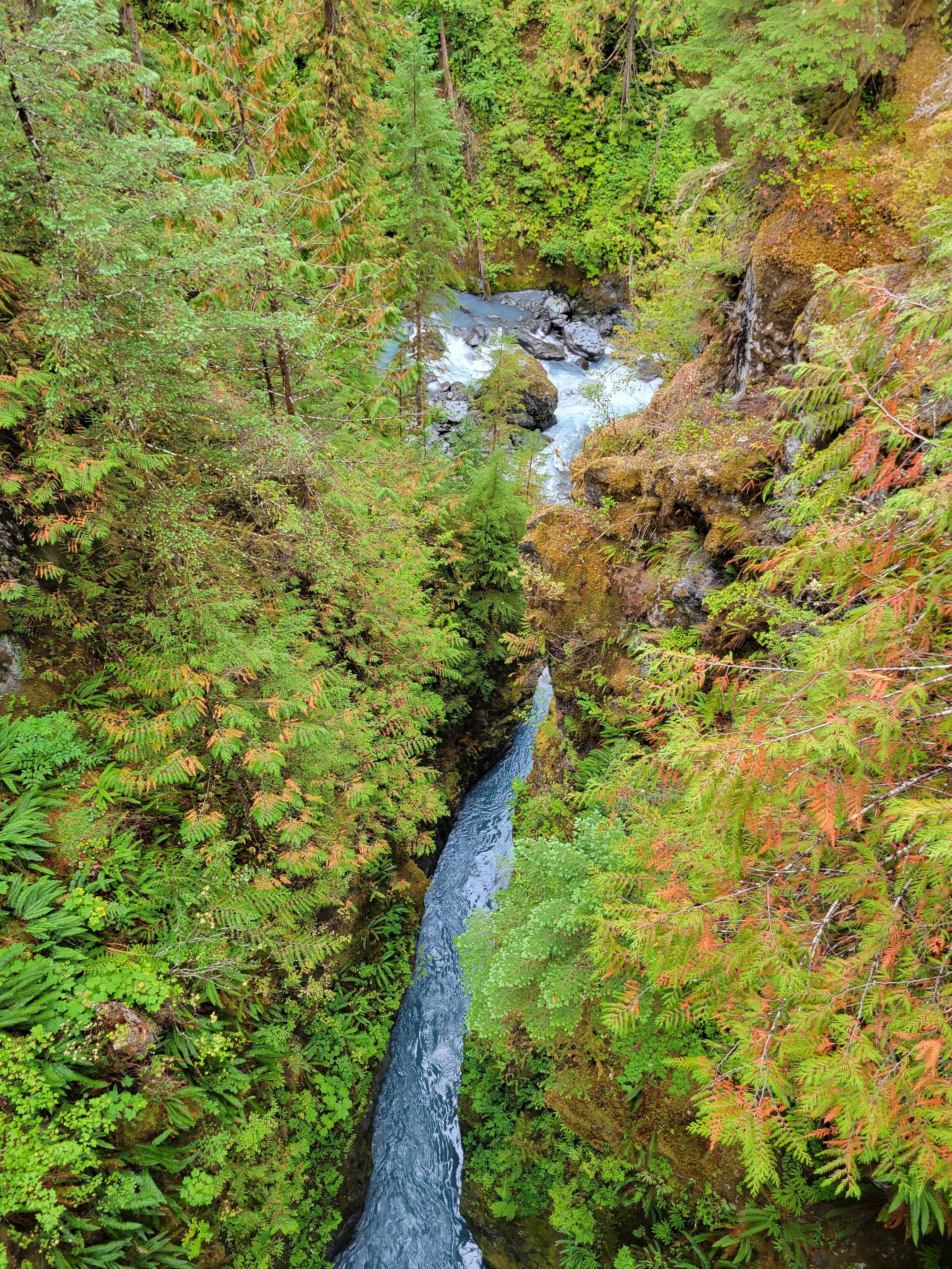
After a two-hour delay getting into the park (Labor Day weekend was a poor choice – lots of day use traffic), we start walking through the Hoh Rainforest in misty rain – I am grateful to experience this cool and damp place in its full glory. At around mile 3, I break off from Dave and Amy and tap into a seemingly endless source of primal energy between mile 3 and 11, overwhelmed by the vitality of the forest. It is so full of life I can just about hear it humming Hohhhhhmmmmmm. I reflect a bit on vibrational kinetic energy, that jittering of molecules that compose all matter in the universe, and all of the flows of energy around me. I am exactly where I am supposed to be. The Hoh is a special place, the wettest forest in the lower 48 states, dominated by giant spruce, hemlock, cedar, and varieties of maples, all covered in thick moss, a place full of so much growth and decomposition. Breaks in the canopy feature grassy meadows interspersed with mossy bigleaf maples that have an eerie and mystical vibe, almost like California’s oak woodlands. I snag a campsite right next to the Hoh River, and Amy and Dave join me a couple hours later.


The next morning I take off early and head up towards Glacier Meadows, a relatively short hike up ~3500 ft through a thick cloud of mist. One thing I have realized after backpacking with a couple different companions is that my mornings are exceptionally quick and efficient: I am so accustomed to the routine of packing up camp that it takes place in just a few minutes. At Glacier Meadows, I set up camp, feel a little chilly now that I have stopped moving, and see that the sky is clear just a bit ahead, so I continue on another mile up above treeline to a small ridge, which looks out onto a vast alpine glacier (“Blue Glacier”) and Mount Olympus. I spend almost an hour enjoying the sun, the glacier, and Mt. Olympus – it’s so sunny I even apply sunscreen. I eventually return to camp and greet Amy and Dave when they arrive. At this point, they are talking about bailing on the rest of the trip. Before the trip, I had pointed out an opportunity to bail on the route, but I didn’t expect it to happen quite so soon. We walk back up to the glacier, but by this time, the clouds have rolled in and we can only see the very edge near the terminal moraine. So we return to camp, where I make the best meal of the entire trip: cheesy vegetable pasta (see end of post for more details).
 |
| Note Alaskan Yellow Cedar |


Tuesday, September 5: Glacier Meadows to Hoh Lake (13 miles)
In the morning, I discover that my sleeping pad has sprung a leak – very bad news! In addition, Dave and Amy are seriously talking about bailing. They tell me there’s a chance they will make it to Hoh Lake, but when I am ready to head out on the trail, we say goodbye as though we are indeed parting ways. Backpacking in the mountains is always a mix of challenges (rain, cold, bugs, uphill climbs etc.) and rewards (glorious sunrises, ridgeline walks, glacier views etc.) and when the challenges start to feel like they are outweighing the rewards, it can be very tough to push on. Descending ~3500 ft towards Lewis Meadow and the junction with the Hoh Lake trail, I get stung by a bee on the left side of my left hand – I guess I will have to hold off on karate chopping for a little while. After going out of my way to fill up water, I begin ascending towards Hoh Lake in a series of switchbacks that climb ~3500 ft over a short distance of no more than a couple miles. By this point, I am very accustomed to the extremely steep terrain of the Olympic mountains. Unlike in the southern Rockies, where glaciers only affected the highest elevations, leaving streams to cut relatively gentle, V-shaped canyons, glaciers in the Olympic Mountains reached the valley bottoms, gouging deep U-shaped gorges with incredibly steep sides. Most trails in Olympic National Park make no attempt at spreading out this elevation gain; they go right up the mountain.
Just before Hoh Lake, I find abundant patches of blueberries and eat as many as I could ever want. I set up camp near the lake and then spend an inestimable amount of time watching a muskrat do laps and eat tadpoles. He is so sleek and graceful when he dives, almost catlike. At one point, he sort of growls and exhales at me – I think I was in one of his favorite tadpole spots. I am also surrounded by grouse, who start to approach very close but then act all flustered when I move or make a noise. There is a tiny part of me that wonders whether Dave and Amy will come marching into camp late that night, but I am not holding my breath. With no phone / camera, I sit and try to burn every last detail of Hoh Lake and its surrounding alpine cirque into my memory, as if I were going to try to paint it later on.


Wednesday, September 6: Hoh Lake to Heart Lake Basin + High Divide (11 miles)
Climbing above treeline from Hoh Lake onto the High Divide that separates the Hoh Valley from the Seven Lakes Basin, my inner fire begins to burn hot and the stoke returns. Rather than do the full Sol Duc loop counterclockwise to my campsite (~15 miles), I decide to take the shorter clockwise route (~3 miles) and then do an out-and-back trail along the High Divide instead (~8 miles roundtrip), which will allow me to remain at high (>4000 ft) elevations and avoid a ~3000 ft descent and ascent. Although the morning begins relatively clear, light rain moves in by mid-morning and obscures most of the distant views of the Hoh Valley for much of the day. I enjoy a misty walk along the High Divide until I arrive at a mound of talus at ~5000 ft lying equidistant between Cat Peak and Mt. Carrie. I can see some informal routes leading across a narrow spine that I later learn are part of an off-trail route known as the Bailey Traverse, which leads southeast towards the Bailey Range (Mt. Ferry, Ludden Peak, Mt. Scott etc.) and the Elwha River basin. I return towards the Heart Lake Basin and camp at a site right off the High Divide trail, which will cut about 1-2 miles and ~1000 ft of elevation gain off of tomorrow’s walk. Sometime in the evening, a ranger busts me for not camping at the site listed on my permit, but because my campsite is very “leave-no-trace” and the site is not reserved, he lets it slide. Facing yet another night sleeping on hard ground with a leaky sleeping pad, my spirits are a bit low as I make my noodle soup and head to bed.
Thursday, September 7: Heart Lake Basin to Hoh Rainforest Trailhead (18 miles)
In the morning, the mist has descended to the valley bottoms and the sun rises above as I hike back along the High Divide trail above the Seven Lakes Basin towards Hoh Lake. I have found that there are two main types of backpackers that I run into: (1) the folks who avoid eye contact and conversation, and exude a sort of a competitive, me-first, selfie-stick vibe and then (2) experienced thru-hiker types, who are clearly in love with the highs and lows of mountain adventures, ready to shoot the shit about their route, stoked to share their tips about the pass they just came down, the alpine lake they just camped at, the family of bears they just saw etc. As I hike the High Divide trail and enjoy glorious sunrise views of the Seven Lakes Basin, I exclusively run into Type (2) backpackers and the camaraderie is strong. I’m feeling great as I descend past Hoh Lake back to the Hoh Valley, and back through the Hoh Rainforest. Within about two miles of the trailhead, I start to run into day-hiker types decked out in full Patagonia attire, clutching cliff bars, carrying expensive cameras. Some pretend I don’t exist, others just stare (“look a smelly backpacker in his natural habitat”), and still others come up with odd things to say like “good job”. I enjoy an excellent night sleeping in the back of my truck in the Hoh Rainforest Trailhead parking lot: the night is dark and quiet, the facilities are clean, and my bed is extremely comfy (especially after two nights on the hard ground).


Friday, September 8: Hoh Rainforest Trailhead to North Cascades
In the morning, I wake up to a family of elk outside the window, the calves making high-pitched noises like peacocks. I prop open the back window of my truck topper and watch them for an hour or so as I wake up. I brew a couple espressos in my Bialetti on the tailgate using my trusty Coleman stove, and then take off for Port Angeles. There, I stop at McDonalds to get Wi-Fi (still no phone), contact various family and friends, and get directions for the remainder of my day. I stop again at the Asian Buffet and eat an unfathomable quantity of sashimi and a couple bowls of soup: beef, broccoli, cabbage, scallions, bean sprouts. Delicious! I then make my way to Port Townsend to catch the ferry to Whidbey Island, but discover that only 20% of the ferry is reserved for “standby” passengers such as myself. I wait from 1:15pm to 5:15pm and finally make it on the ferry. This adds an element of stress to my journey that I wasn’t expecting – I make my way to Chipotle and Grocery Outlet using notes that I had scribbled down from Google Maps (still no phone), and then drive in the dark toward Rockport, where I finally locate my parents’ Airbnb after driving slowly down the road and searching for addresses. Phoneless life isn’t too bad, but navigating in the dark without Google Maps is hard!
Conclusion – North Cascades:
For the last few days, I’ve been hanging out with my folks at their Airbnb in Rockport, WA and going into North Cascades National Park during the day, checking out lots of overlooks, and going on short (~4 mile) hikes. There are a handful of small fires in and around the park, but we’ve managed to find areas to explore that aren’t smoky. The North Cascades are a very impressive, steep, and rugged range that I never really knew existed, aside from seeing them on the map northeast of Seattle. I might have to plan a backcountry trip back here at some point, maybe during the spring or early summer when fire isn’t a constant presence.
One of the biggest takeaways from the summer is my strong desire to remain in cool, foggy, and damp coastal places for the indefinite future, for both my home life and travel. During the parts of the summer that brought me away from the cool and damp (e.g., Bend and eastern side of North Cascades) I immediately felt out of place. I belong with the slugs.
And now it’s time for another Aunt Carolyn style self interview.
What kind of wildlife did you see?
- Black bears: a single adult near Heart Lake and a mother and cub in the Seven Lakes Basin
- Elk: a pair of bulls in the Heart Lake Basin and a family of two cows and 4-5 calves in the Hoh Rainforest
- Hoh Lake was full of life: a muskrat, grouse, and lots of tadpoles
- Marmots on Grand Pass
- A ptarmigan on some pass or summit, can’t remember which
- Lots of slugs and deer just about everywhere
What did you eat?
My main staple was tallow (rendered beef fat) from grass-fed cows: I mixed it into all of my dinners. These consisted mainly of meals I assembled from dried foods purchased at Win-Co foods (a West Coast grocery chain), and were some of the most sophisticated and delicious backpacking meals I’ve ever created. Here is a summary (all foods dried unless otherwise noted):
- Rice Noodle Soup: rice noodles, veggie soup mix, coconut cream powder, tallow
- Refried Beans: refried bean flakes, berbere, onion flakes, tallow
- Egg Noodle Pasta: egg noodles, grated parmesan, veggie soup mix, tallow
- Cheesy Potatoes: shredded potatoes, grated parmesan, veggie soup mix, tallow
The egg noodle pasta was by far the best – I got the texture exactly right (no draining of the pasta water) and it turned into a creamy bowl of cheesy deliciousness. The rice noodle soup was perfect for cool and rainy days (especially the hot and salty broth), and the refried beans were a trusty favorite for a quick, hot, and savory meal. For breakfast, I drank a whey protein beverage with stevia and cocoa that helped a lot with the soreness in my calves, quads, and shoulders. For lunch, I ate a salted avocado or an exciting new mixture I came up with on this trip: mashed avocado, salmon packet, and crunchy roasted chickpeas or edamame. Like toast in a bowl!
Favorite trees of the summer?
Hemlock and Alaskan Yellow Cedar! They both have a distinctly shaggy and ragged look that is shared by all my favorite trees, including tamaracks and black spruces. I've noted the yellow cedar in a photo above where it appears.
Any big takeaways from two weeks without a phone?
By the end, I loved it. While navigating without Google Maps was certainly a challenge, I felt liberated and empowered to be fully present and enjoy an authentic experience without the need to document every moment. Of course, I benefited from my friends' photos!
How are you feeling about future trips? Any plans?
By the end of these trips I’m always ready to swear off sleeping on the ground in tents forever, so I’m definitely in the mood to stick to camping out of my truck, which has a comfy full-sized bed in the back. I’m looking forward to lots of weekend trips with Raf exploring our new surroundings, as well as some potential international adventures. I am also thinking of redirecting some of my wilderness energy towards hunting, possibly elk: I love eating wild meat, undertaking great physical challenges (e.g., hauling elk quarters), and spending lots of time in nature observing and listening, so I think it’s a great fit. Stay tuned!
Epilogue – Back to the Bay Area:
I’ve held off on publishing this post, as it took a bit longer than usual to pull together photos and select the best, so my surroundings continue to evolve. On Tuesday of this week, I drove ~16 hours from North Cascades all the way back to the Bay Area and moved into our new home with Raffelina (between La Honda and San Gregorio). On Wednesday, I retrieved all our stuff from the storage unit in Oakland with a U-haul trailer, set up my home office, and installed Starlink satellite internet for work the next day. This rambling summer has been one of my favorites: I’ve explored so many places that I’ve been meaning to visit for a long time, with plenty of time in solitude, among family, and in community. And it keeps getting better! Our new home is perfect in every way: quiet and peaceful, big windows looking out onto the Coast Live Oaks that surround the house, friendly upstairs neighbors, rolling hills with mountain bike trails, a 7-mile bike ride down a rural country road to the ocean, 45 minute drive to Bay Area cities, even a hot tub! The other day I milked a goat and then made a potato onion puree with the goat milk. I harvested a bunch of pears and will soon make pear butter. And the best part is I get to enjoy it all with Raffelina. Ciao for now!
No comments:
Post a Comment